Two ponds from the Pierre Vérots Foundation equipped as part of the French National Water Temperature Monitoring Network (Réseau national de suivi de la température plans d’eau)
 The National Water Temperature Monitoring Network Network (Réseau national de suivi de la temperature des plans d’eau) aims to track the warming trajectories of French water bodies in the context of global warming. The water bodies included in the network are representative of specific typologies, biodiversity stakes, or ecosystems services.
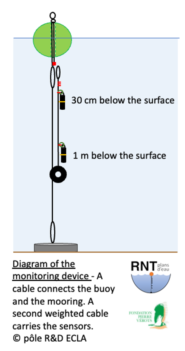
In March 2025, two ponds from the Pierre Vérots Foundation, located on the Dombes plateau (Ain, France), were equipped according to the network protocol: two sensors will record temperature at fixed depths and hourly time intervals. Combined with pond level monitoring data, this data will be used to calculate metrics on habitat quality. Variations of these metrics on an annual scale and over the coming decades will improve our understanding of the response of water bodies to climate change.
The specific characteristics of the Foundation's ponds relate to their location (in a chain) and their management (regular drying). These two ponds join a network of nearly 30 bodies of water, from Lake Serre-Ponçon (the largest reservoir in France) to Lake Grand Lieu (the largest natural plain lake in France), passing through Lake Pavé (Écrins National Park, the highest lake in the network at 2,841 m).
More information on the network: https://professionnels.ofb.fr/fr/node/453
More information on the Pierre Vérots Foundation: www.fondation-pierre-verots.fr
Last update on 03/04/2025.